About M@TE
About M@TE
M@TE is designed to meet geoscientists where they are: from educators and students using visualizations in the classroom to researchers developing and benchmarking new numerical models. It lowers the learning curve of numerical models and bridges the gap between traditional geology and numerical geosciences.
M@TE enables you to:
- Explore and visualize models through an intuitive web interface: play animations, use them in your teaching or to better understand Earth system concepts.
- Download and build on models by accessing input files and configuration scripts to reproduce or expand upon simulations on your own.
- Analyze and benchmark model outputs by comparing results across models and datasets without having to recreate simulations from scratch.
- Upload your own models using streamlined tools for packaging code, metadata and outputs. These are stored, preserved and assigned a DOI for citation. (Currently by invitation only, as we are being intentional about showcasing a diverse and representative set of models.)
Together we build reproducible, reusable, robust models — it takes a village — so please cite the models you use.
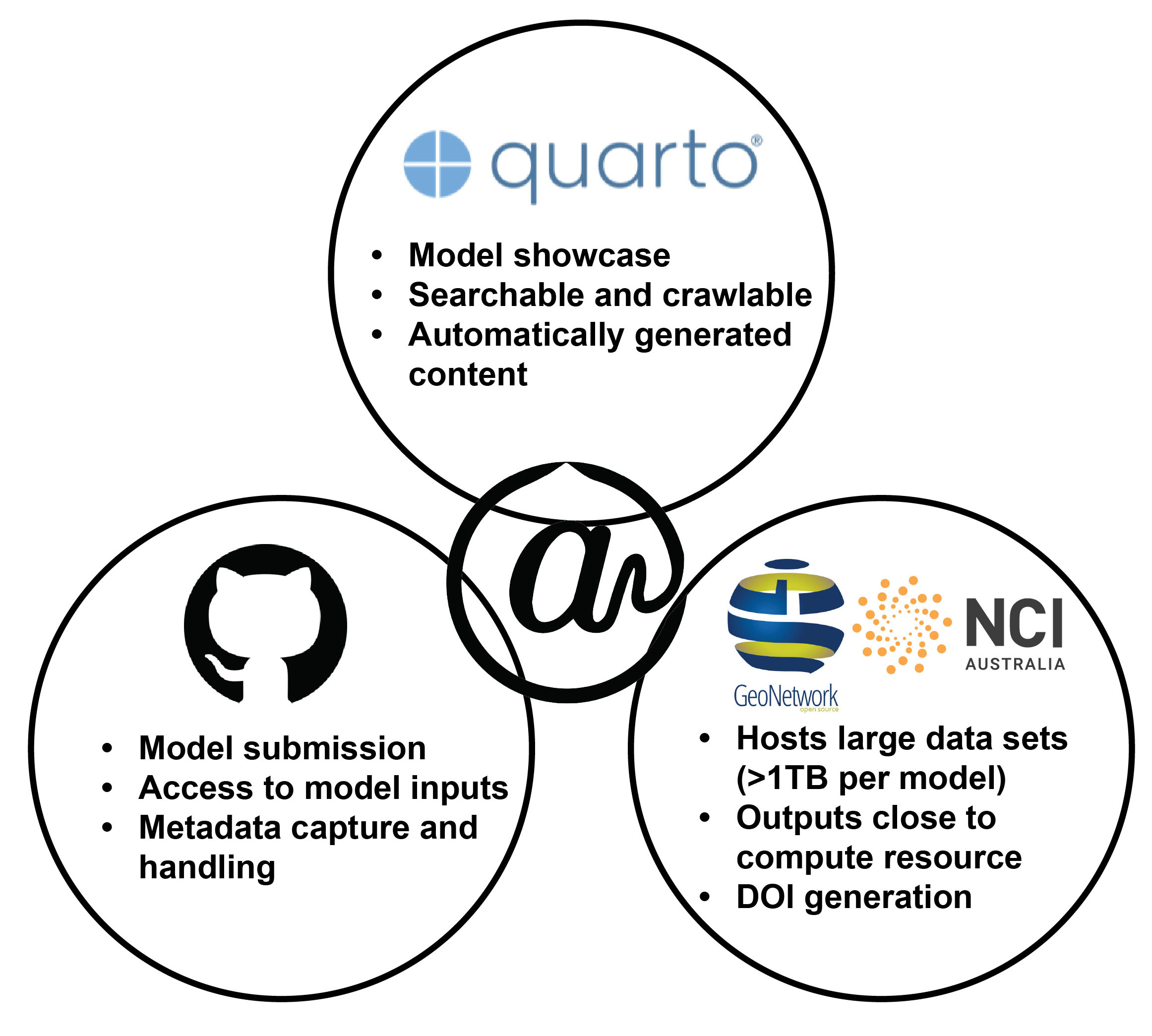
How does M@TE work?
M@TE combines a user-friendly experience with a robust backend built on widely adopted, sustainable infrastructure. Users browse model summaries through the website, which links to GitHub and NCI repositories for downloading code and outputs. Behind the scenes, carefully chosen tools ensure consistency, accessibility and long-term preservation.
Key design choices include:
RO-Crates for packaging
Model metadata is packaged using the RO-Crate standard, a lightweight JSON-LD format that captures rich metadata and references model components (e.g. code, inputs, outputs, publications, authors and persistent identifiers). This ensures models are machine-readable and FAIR (Findable, Accessible, Interoperable, Reusable).
GitHub for submission and validation
Models are submitted through structured GitHub issue templates. Metadata is automatically validated and enriched via GitHub Actions, which connect to external services such as Crossref, DataCite and ORCID.
Quarto for showcasing
This replica of the M@TE website is built with Quarto, a scientific publishing system that delivers a fast, lightweight interface for browsing models. It integrates figures, animations and interactive content to make models discoverable and usable across different audiences. (The original M@TE site uses Gatsby, a React-based static-site generator.)
NCI GeoNetwork for storage and preservation
Model outputs are stored and preserved through the National Computational Infrastructure (NCI) GeoNetwork. This system supports terabyte-scale data, assigns persistent DOIs and ensures discoverability through standard catalog services.
Content ingestion mechanism
Each scientific model has its own repository in the ModelAtlasofTheEarth GitHub organisation. When a model is ready for publication, a GitHub Actions workflow automatically:
- Updates the DOI in the model repository
- Creates a new branch in the website repository named after the model
- Copies the
.website_material/folder contents intomodels/<model-name>.qmdin the Quarto site - Updates the model submission issue tracker
The branch is then merged and the site rebuilds automatically — no manual file copying required.